JOIN NOVA CARTOGRAFÍA and chart your future with us
Why join Nova Cartografía?
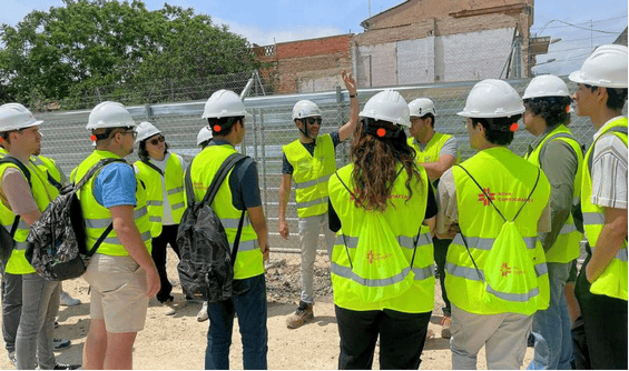
High-impact projects in different construction and civil works sectors
Access to the latest technology in surveying, cartography, and geodesy
Training and continuous learning with a team of experts
Opportunities for recent graduates and experienced professionals
Collaborative and dynamic work environment, with great possibilities for growth
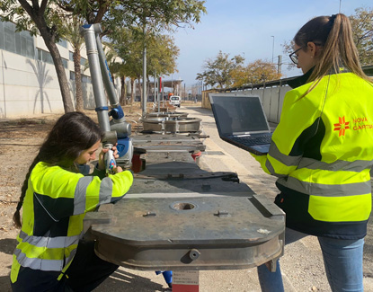
At Nova Cartografía, we are looking for motivated people, willing to contribute their knowledge and experience in various areas of topography.
What kind of work do we do?
Topographic surveys
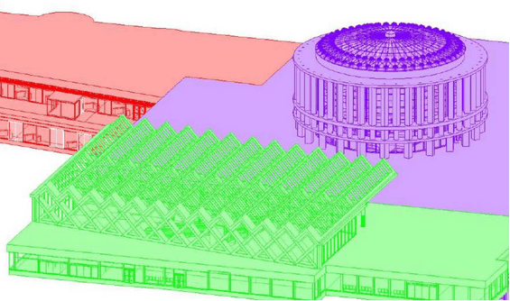
Generation of detailed terrain models and maps.
On-site stakeout
Generation of detailed terrain models and maps.
Geodetic networks
Creation and maintenance of geodetic reference frames.
Polygonal
Control and measurement of structures using advanced techniques.
High-precision geometric leveling
Control of heights and levelling to guarantee the stability of the works.
What will you learn at Nova Cartografía?
We are committed to providing you with the experience and skills that complement your educational background.
At Nova Cartografía, we want you to become a highly qualified professional, ready for the challenges and opportunities of the future.
We know that the industry is moving fast, and the key is to stay up to date with the latest methodologies and tools:
- Real use of cutting-edge technology:
You will use state-of-the-art equipment such as laser scanners, drones and total stations. - Practical application of industry-leading software: You'll be trained in essential tools such as Infinity Leica, MDT 9, Metashape, and AutoCAD Civil 3D.
- Acquire advanced techniques: We want you to master innovative methods.
- Participate in real projects: You will be integrated into large-scale projects in various fields, gaining invaluable experience.
- Optimize your work with agile methodologies: You will learn to be a more efficient and precise person both in the field and in the office.
High-impact projects
Project management and management team committed to finding the most viable and personalized solutions for the different sectors with which we work: construction companies, engineering companies and public companies.
Access to the latest technologies
Innovation is one of the fundamental pillars on which Nova Cartografía is built. We firmly believe in continuous improvement and investment in R+D+i. We have obtained the Innovative SME seal.
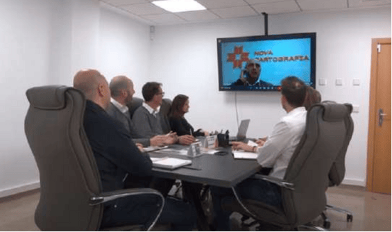
Free in-house training plan
Free in-house training every month for your professional growth from qualified and experienced professionals.
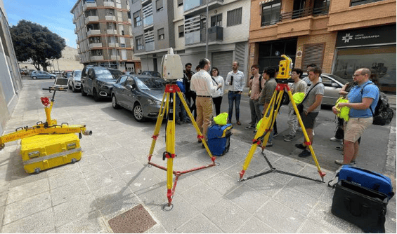
Topographic instruments we work with:
Total Station
Angular and distance measurement with maximum precision
GPS
Geospatial positioning with high-precision GNSS systems
Digital level
High-precision geometric leveling
Laser scanner
Capturing Point Clouds for 3D Modeling
Drone
Photogrammetry and high-precision aerial surveys
Industry-leading software:
Infinity Leica
Advanced topographic data processing
MDT 9
Digital terrain modeling
Metashape
3D reconstruction from photogrammetry
AutoCAD Civil 3D
Design and planning of infrastructures in BIM environments
Measurement Manager
Optimization and control of surveying projects
Job opportunities
Whether you are a recent graduate or an experienced professional, at Nova Cartografía you will find job opportunities.
Collaborative and dynamic environment
Collaborative and dynamic work environment, with great possibilities for growth.
In which sectors do we work?

Railway works
Precision surveys and stakeouts for railway infrastructures

Road works
Control and execution of road layouts with advanced technology

Building works
Surveying work in construction and urban planning projects
At Nova Cartografía you will find the ideal environment to boost your career.
Why trust Nova Cartografía?

Geomatics and surveying professionals with 20 years of experience

Immediacy 48-72h
Average workforce of 100 professionals

State-of-the-art technologies
Laser scanner and drone

We cover national and international projects
Nova Cartografía, Inc.
1304 Langham Creek Dr.
Suite 410
Houston, TX 77084
Tel.: +1 832 451 9545 · +34 617 07 48 81
alejandro.moure@novacartografia.com
engineering.usa@novacartografia.com
Spain:
C/ l'Alcalaten 5, Bajo Izquierda
46900 Torrent (Valencia)
========================
Centro de negocios MEEU
Estación de Chamartín planta ático
despacho D105
28036 Madrid

© 2017 GRUPO NOVA CARTOGRAPHIA SL. Todos los derechos reservados. Desarrollado por kuombo